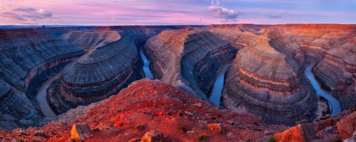
Reservoir in the United States of America
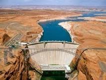
Lake Powell is a reservoir on the Colorado River in Utah and Arizona, United States. It is a major vacation destination visited by approximately two million people every year. It holds 24,322,000 acre-feet (3.0001×10¹⁰ m3) of water when full, second in the United States to only Lake Mead – though Lake Mead has fallen below Lake Powell in size several times during the 21st century in terms of volume of water, depth and surface area.
Lake Powell was created by the flooding of Glen Canyon by the Glen Canyon Dam, which also led to the 1972 creation of Glen Canyon National Recreation Area, a popular summer destination of public land managed by the National Park Service. The reservoir is named for John Wesley Powell, a civil war veteran who explored the river via three wooden boats in 1869. It lies primarily in southern Utah, with a small portion in northern Arizona.
Lake Powell is a water storage facility for the Upper Basin states of the Colorado river Compact (Colorado, Utah, Wyoming and New Mexico). The Compact specifies that the Upper Basin states are to provide a minimum annual flow of 7,500,000 acre-feet (9.3 km3) to the Lower Basin states (Arizona, Nevada, and California).
According to US Geological Survey and the Bureau of Reclamation report, in addition to water loss, Lake Powell faced an average annual loss in storage capacity of about 33,270 acre-feet, or 11 billion gallons, per year between 1963 and 2018 because of sediments flowing in from the Colorado and San Juan rivers. Those settle at the bottom of the reservoir and decrease the total amount of water the reservoir can hold. Environmentalists have pushed to drain Lake Powell and restore Glen Canyon to its natural, free-flowing state.
History
Planning
In the 1940s and early 1950s, the United States Bureau of Reclamation planned to construct a series of Colorado River dams in the rugged Colorado Plateau province of Colorado, Utah, and Arizona. Glen Canyon Dam was born of a controversial damsite the Bureau selected in Echo Park, in what is now Dinosaur National Monument in Colorado. A small but politically effective group of objectors, led by David Brower of the Sierra Club, succeeded in defeating the Bureau’s bid, citing Echo Park’s natural and scenic qualities as too valuable to submerge.
Glen Canyon Dam was built to solve the downstream delivery obligations of the Upper Basin states. Lake Powell is an “aquatic bank” built to fulfill the terms of the “Compact Calls” of Lower Basin.
Construction
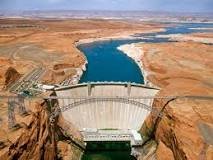
Construction on Glen Canyon Dam began with a demolition blast keyed by the push of a button by President Dwight D. Eisenhower at his desk in the Over Office on October 1, 1956, which started clearing tunnels for water diversion. On February 11, 1959, water flowed through the tunnels so dam construction could begin. Later that year, the bridge was completed, allowing trucks to deliver equipment and materials for the dam and also for the new town of Arizona.
Concrete placement started around the clock on June 17, 1960. The last bucket of over 5 million cubic yards (4,000,000 m3) was poured on September 13, 1963. The dam is 710 feet (216 m) high and the surface elevation of the water at full-pool is approximately 3700 feet (1100 m). Construction cost $155 million, and 18 lives were lost. On September 22, 1966, Glen Canyon Dam was dedicated by Lady Bird Johnson. From 1970 to 1980, turbines and generators were installed for hydroelectricity.
Filling and operations
Upon completion of Glen Canyon Dam on September 13, 1963, the Colorado River began to back up, no longer being diverted through the tunnels. The newly flooded Glen Canyon formed Lake Powell. Sixteen years elapsed before the lake filled to the 3,700 feet (1,100 m) level on June 22, 1980. The lake level fluctuates considerably depending on the seasonal snow runoff from the Rocky Mountains. The all-time highest water level was reached on July 14, 1983, during one of the heaviest Colorado River floods in recorded history, in part influenced by a strong EI Nino event. The lake rose to 3,708.34 feet (1,130.30 m) above sea level, with a water content of 25,757,086 acre-feet (31.770898 km3). It lies primarily in parts of Garfield, Kane, and San Juan counties in southern Utah, with a small portion in Coconino County in northern Arizona. The northern limits of the lake extend at least as far as the Hite Crossing Bridge.
21st century drought and push to drain

Chart showing daily water volume observations for Lake Powell, from Jun 28, 1963 to December 16, 2023Lake Powell surface area shrinkage

Colorado River flows have been below average since 2000 as a result of the southwestern North American megadrought, leading to lower lake levels. In winter 2005 (before the spring run-off) the lake reached its then-lowest level since filling, an elevation of 3,555.10 feet (1,083.59 m) above sea level, which was approximately 150 feet (46 m) below full pool. After 2005, the lake level slowly rebounded, although it has not filled completely since then. Summer 2011 saw the third largest June and the second largest July runoff since the closure of Glen Canyon Dam, and the water level peaked at nearly 3,661 feet (1,116 m), 77 percent of capacity, on July 30. However, water years 2012 and 2013 were, respectively, the third and fourth-lowest runoff years recorded on the Colorado River. By April 9, 2014, the lake level had fallen to 3,574.31 feet (1,089.45 m), largely erasing the gains made in 2011.
Colorado River levels returned to normal during water years 2014 and 2015 (pushing the lake to 3,606 feet (1,099 m)) by the end of water year 2015. The Bureau of Reclamation in 2014 reduced the Lake Powell release from 8.23 to 7.48 million acre-feet, for the first time since the lake filled in 1980. This was done due to the “equalization” guideline which stipulates that an approximately equal amount of water must be retained in both Lake Powell and Lake Mead, in order to preserve hydro-power generation capacity at both lakes. This resulted in Lake Mead declining to the lowest level on record since the 1930s.
Long-term water level decline continued, forcing an emergency release of water from the Flaming Gorge Reservoir in July 2021. and by April 22, 2022, Lake Powell was at 3,522.24 feet (1,073.58 m) in elevation – just 22.88% of capacity. This marks the lowest water level for Lake Powell since it was filled in 1963.
The capacity of Lake Powell has decreased by 7% since 1963 facing an average annual loss of 33,270 acre-feet of storage, due to the inflow of sediments from Colorado and San Juan rivers
Peer-reviewed studies indicate that storing water in Lake Mead rather than in Lake Powell would yield a savings of 300,000 acres feet of water or more per year, leading to calls by environmentalists to drain Lake Powell and restore Glen Canyon to its natural, free-flowing state.
Landmarks and features
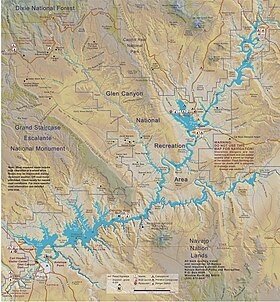
The lake’s main body stretches up Glen Canyon but has also filled many (over 90) side canyons. The lake also stretches up the Escalante River and San Juan River where they merge into the main Colorado River. This provides access to many natural geographic points of interest as well as some remnants of the Anasazi culture.
Glen Canyon Dam, the dam the blocks the Colorado River and forms Lake Powell. (Arizona)
Glen Canyon Dam, rising 710 feet above bedrock within the steep, rust-colored sand-stone walls of Glen Canyon, was constructed to harness the power of the Colorado River in order to provide for the water and power needs of millions of people in the West
Rainbow Bridge, one of the world’s largest natural bridges. (Utah)

The belief has many antecedents, including similarities to the Bifröst bridge of Norse mythology. The Rainbow Bridge is a meadow where animals wait for their humans to join them, and the bridge that takes them all to Heaven, together.
Hite Crossing Bridge
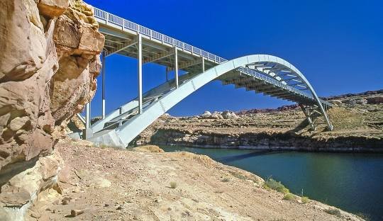
The only bridge spanning Lake Powell. Although the bridge informally marks the upstream limit of the lake, when the lake is at its normal high-water elevation, backwater can stretch up to 30 miles (48 km) upstream into Cataract Canyon.
Defiance House ruin (Anasazi)
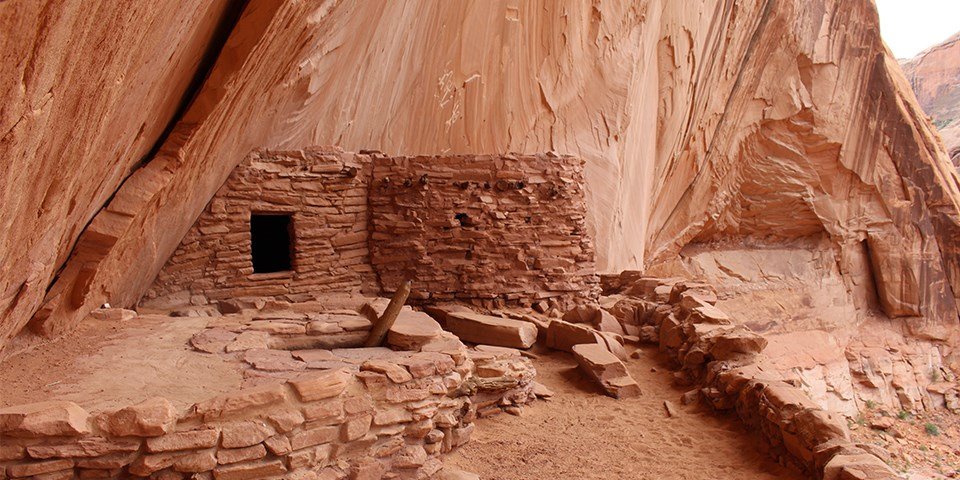
The Glen Canyon area was on the outskirts of the Ancestral Puebloan world. Few large communities were built in this area, but evidence of people here is still plentiful. People used the canyons as corridors to travel across the otherwise harsh and challenging landscape, and farmed along the beds of the canyons where water could be found. They collected the natural resources found here, continuing to use the knowledge developed by their early hunter-gatherer ancestors. Cultural sites that can teach us about the people who lived here during that time include petroglyphs and pictographs, storage structures used by farmers to store their crops, places where people came to extract and process stone for tools, and, of course, the places they lived.
Castle Rock

The Castle Rock Cut is one of the most important navigational channels in the lake; it was blasted as early as the 1970s to allow boaters to bypass the winding canyons between the Glen Canyon Dam and reaches of Lake Powell further upstream – saving, on average, one hour of travel time.
Cathedral in the Desert

The Cathedral in the Desert is a natural formation, sometimes referred to as an amphitheater, buried under Lake Powell in Glen Canyon. Due to the Southwestern North American megadrought, the cathedral has been visible in 2005 and 2019. Lake Powell must drop to 3,605 feet for the cathedral floor to be visible.
San Juan goosenecks

Goosenecks State Park is a state park in the U.S. state of Utah, overlooking a deep meander of the San Juan River. The park is located near the southern border of the state a short distance from Mexican Hat, Utah.
A visit to Goosenecks is worth the drive for the view alone. But once you get there, why not stay awhile and enjoy this unique destination? If you like spending time outdoors, there is plenty to do here.
Gregory Butte

Gregory Butte is a 4,651-foot elevation sandstone summit located in Glen Canyon National Recreation Area, in San Juan County of southern Utah. It is situated 7.3 miles northeast of Tower Butte, and 16 miles northeast of the town
Gunsight Butte

Gunsight Butte is a 4,678-foot-elevation sandstone summit located in Glen Canyon National Recreation Area, in Kane County of southern Utah. It is situated 12 miles northeast of the town of Page. Gunsight Butte is an island that towers nearly 1,000 feet above Lake Powell when the lake is full.
Lone Rock
The ‘lone rock,’ as it was called by rafters, served as a visual landmark for ferry and river boat commuters in the early 19th century, who transported goods like, furs and lumber and it was also a major passageway for local Indian tribes.
History. According to a sign near the site, “The Lone Rock – At one time a massive piece of sandstone stood a short distance from the north bank of the Wisconsin River. The rock became a landmark for early river raftsmen and was known as ‘Lone Rock’ from which the town took its name.
Alstrom Point
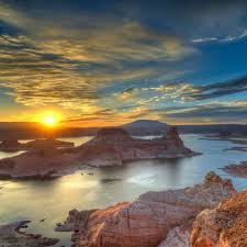
Lake Powell reached ‘full pool’ – 3700′ above sea level for the first time. Since then, it’s become the ultimate destination for houseboating, lodging, and camping/RV vacations. Lake Powell is arguably the most scenic lake in America, situated in some of Southern Utah’s finest red-rock desert country.
Lake Powell acts as a holding tank for outflow from the Colorado River Upper Basin States: Colorado, New Mexico, Utah and Wyoming. The water stored in Lake Powell is used for recreation, power generation and delivering water to the Lower Basin states of California, Arizona, and Nevada.
Kaiparowits Plateau

The Kaiparowits Plateau is a large, elevated landform located in southern Utah, in the southwestern United States. Along with the Grand Staircase and the Canyons of the Escalante, it makes up a significant portion of the Grand Staircase–Escalante National Monument.
Hole-in-the-Rock crossing
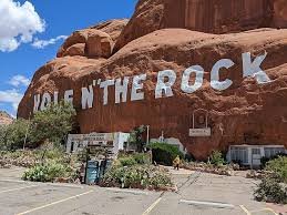
The Hole-in-the-Rock road is an historic pioneer trail turned path to adventure. This 62 mile (100 km) one-way section runs from Escalante, UT to the western edge of Lake Powell. This road is rough, impassable in inclement weather, and 4WD only for the last 7 miles.
The Rincon

Rincón (Spanish pronunciation) is a popular beach town and municipality of Puerto Rico founded in 1771 by Don Luis de Añasco, who previously founded Añasco in 1733. It is located in the Western Coastal Valley, west of Añasco and Aguada.
Three-Roof Ruin
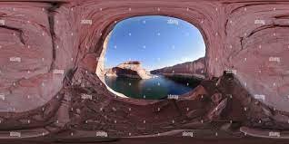
Three Roof Ruin is one of the most spectacular Anasazi sites in Lake Powell country. It is found between Willow Creek and Explorer Canyon in the main Escalante channel. As you travel upriver, keep a close eye out and you will see it high in the cliffs on a big bend off to your port side.
Water pocket Fold
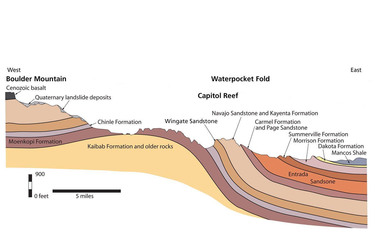
The name “Waterpocket Fold” reflects this ongoing erosion of the rock layers. “Waterpockets” are small depressions that form in many of the sandstone layers as they are eroded by water, and are common throughout the fold at Capitol Reef.
Padre Bay

Padre Bay is a bay within Lake Powell, on the Colorado River in Kane County and San Juan County, Utah. Its waters reach an elevation of 3,704 feet. Located 13.5 miles northeast of Glen Canyon Dam in Lake Powell, Padre Bay is the largest expanse of open water on the man made lake.
